Ferris Fire Grows to 64,869 Acres, Reaches 43% Containment
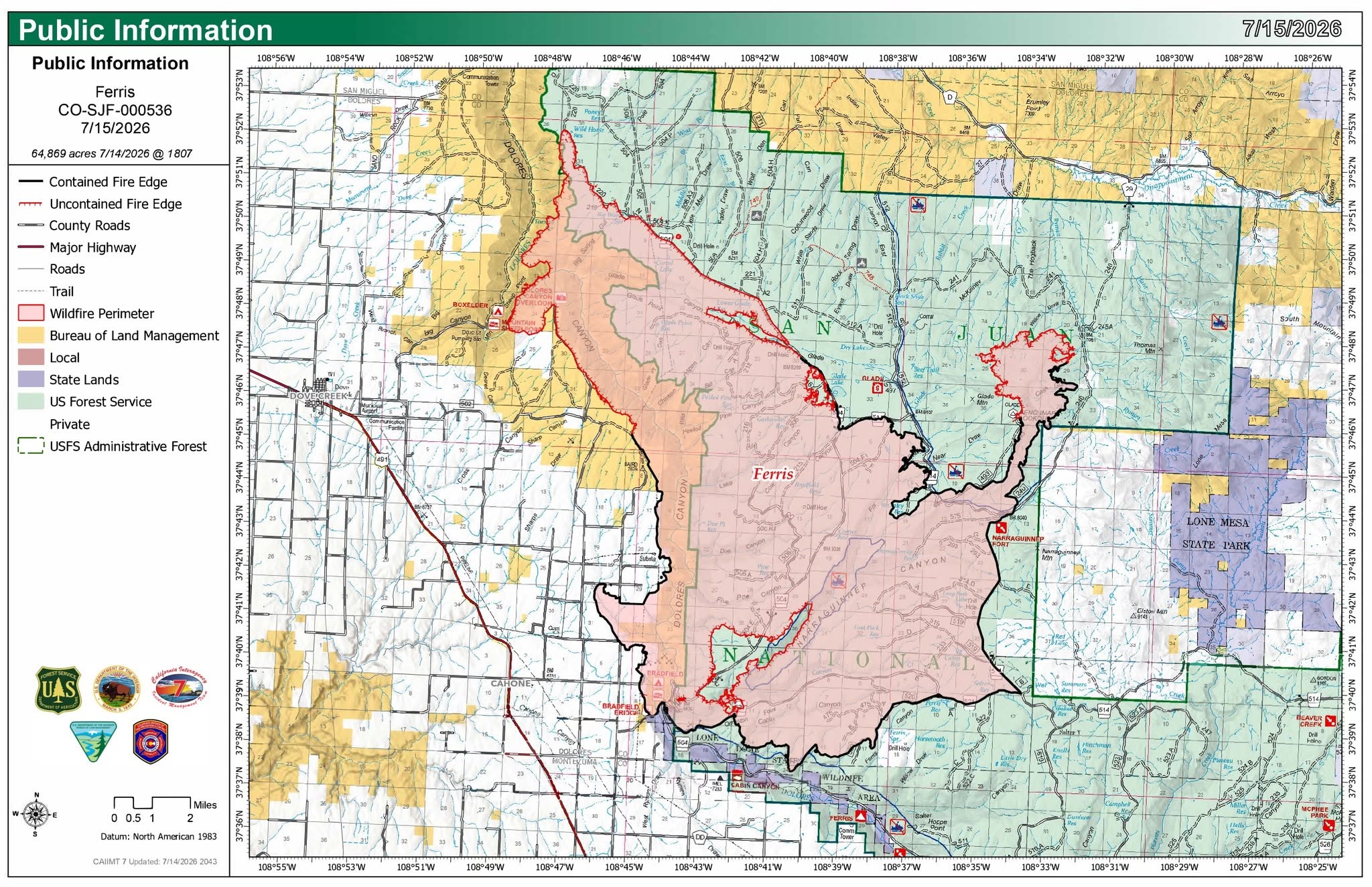
Description: The Ferris Fire is 43% contained at 64,869 acres as 1,105 personnel strengthen northern firelines and begin suppression repair amid cooler, wetter weather...
Published: 3 hours ago
Byline: SECO News

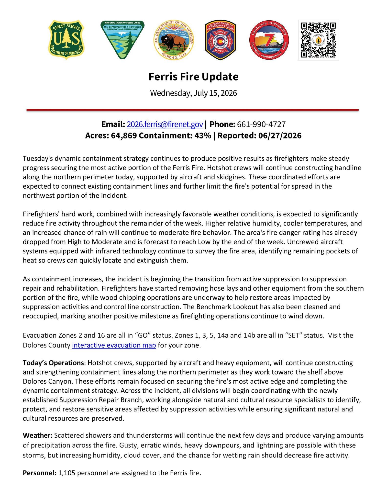
Ferris Fire Update
Wednesday, July 15, 2026
Email: 2026.ferris@firenet.gov | Phone: 661-990-4727
Acres: 64,869 Containment: 43% | Reported: 06/27/2026
Tuesday's dynamic containment strategy continues to produce positive results as firefighters make steady progress securing the most active portion of the Ferris Fire. Hotshot crews will continue constructing handline along the northern perimeter today, supported by aircraft and skidgines. These coordinated efforts are expected to connect existing containment lines and further limit the fire's potential for spread in the northwest portion of the incident.
Firefighters' hard work, combined with increasingly favorable weather conditions, is expected to significantly reduce fire activity throughout the remainder of the week. Higher relative humidity, cooler temperatures, and an increased chance of rain will continue to moderate fire behavior. The area's fire danger rating has already dropped from High to Moderate and is forecast to reach Low by the end of the week. Uncrewed aircraft systems equipped with infrared technology continue to survey the fire area, identifying remaining pockets of heat so crews can quickly locate and extinguish them.
As containment increases, the incident is beginning the transition from active suppression to suppression repair and rehabilitation. Firefighters have started removing hose lays and other equipment from the southern portion of the fire, while wood chipping operations are underway to help restore areas impacted by suppression activities and control line construction. The Benchmark Lookout has also been cleaned and reoccupied, marking another positive milestone as firefighting operations continue to wind down.
Evacuation Zones 2 and 16 are all in “GO” status. Zones 1, 3, 5, 14a and 14b are all in “SET” status. Visit the Dolores County interactive evacuation map for your zone.
Today’s Operations: Hotshot crews, supported by aircraft and heavy equipment, will continue constructing and strengthening containment lines along the northern perimeter as they work toward the shelf above Dolores Canyon. These efforts remain focused on securing the fire's most active edge and completing the dynamic containment strategy. Across the incident, all divisions will begin coordinating with the newly established Suppression Repair Branch, working alongside natural and cultural resource specialists to identify, protect, and restore sensitive areas affected by suppression activities while ensuring significant natural and cultural resources are preserved.
Weather: Scattered showers and thunderstorms will continue the next few days and produce varying amounts of precipitation across the fire. Gusty, erratic winds, heavy downpours, and lightning are possible with these storms, but increasing humidity, cloud cover, and the chance for wetting rain should decrease fire activity.
Personnel: 1,105 personnel are assigned to the Ferris fire.
Evacuations and Closures: Dolores, Montezuma and San Miguel counties have active evacuation orders in place. An interactive evacuation map is available at: http://tinyurl.com/FerrisFireEvacMap. For current information see the Dolores County Office of Emergency Management Facebook page, the Montezuma County Sheriff’s Office Facebook page and/or the San Miguel County Sheriff Facebook page. The San Juan National Forest has a Fire Area Closure in place as does the Bureau of Land Management for Bradfield Bridge and Box Elder Recreation Areas and multiple roads on the north end of the Ferris Fire.
NO DRONE ZONE: Private aircraft, including drones, are not allowed over the fire or McPhee Reservoir. A Temporary Flight Restriction (TFR) is in effect over the fire area.
Smoke Information: A weak inversion settled smoke overnight, but air quality is expected to be GOOD in areas around the fire by late morning through the evening. Smoke is likely to continue from the Dolores Canyon area in the north of the fire. Pockets of unburned fuel may produce localized smoke and settle into areas around the Ferris Fire. Conditions are likely to deteriorate to MODERATE air quality in the evening, overnight, and early morning around Dolores, Cortez, and Ute.
Follow SECO News on Facebook.
Subscribe to the SECO News YouTube Channel.
Click to Zoom

Press releases Sponsor




.png)


.png)
















.png)


.png)







